GeoExplorer
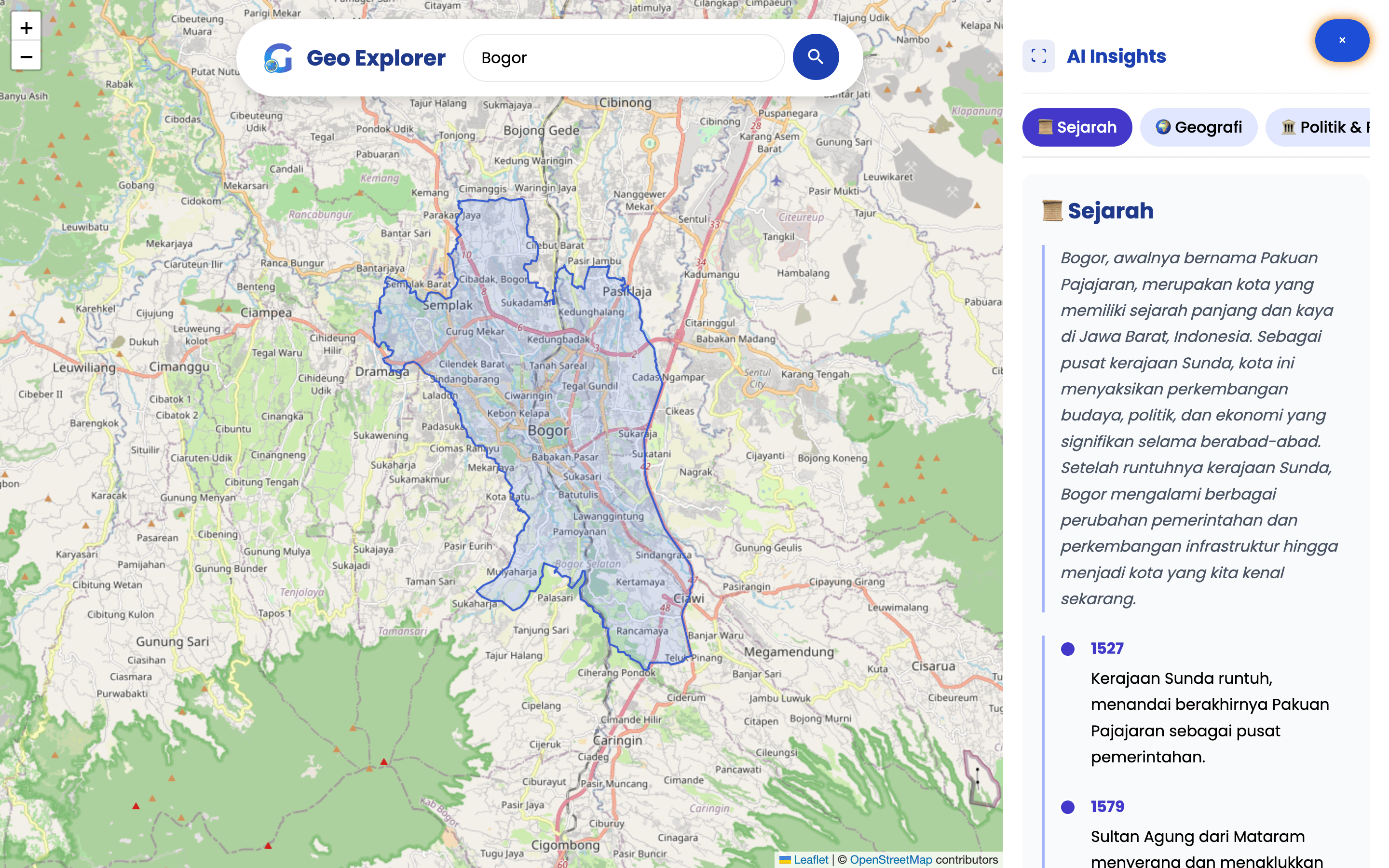
GeoExplorer
― An interactive map that connects place search with structured AI context
A map can locate a place, while a search engine can explain it. Users often switch between both tools when they want geographic, historical, economic, or policy context. GeoExplorer puts that sequence in one interface.
| Field | Record |
|---|---|
| Role | Product builder and developer |
| Period | 2025 |
| Status | Deployed prototype |
| Implementation | React application with Leaflet, Nominatim, and Gemini integration |
Problem
Location search returns coordinates and boundaries. It does not answer the next questions a student, traveler, or researcher may ask. General web search can answer them, though it breaks the spatial context and forces users to assemble the result.
Role and scope
I built the search, map, location boundary, category panel, and AI response flow. I also handled responsive layout and loading states.
The product provides generated context for exploration. It does not verify Gemini output against cited sources, so users should treat each response as a starting point.
Process and decisions
Nominatim converts the search term into coordinates, a bounding box, and available geometry. Leaflet centers the map and draws the place boundary. The selected location then anchors a Gemini request across categories such as history, geography, environment, and economics.
I placed loading feedback inside the information panel so the map remained usable during generation. I also used the location type and bounding box to choose a useful zoom level.
Working build
The deployed prototype handles global place search, area polygons, map movement, topic selection, and generated responses. The interaction keeps the selected boundary visible while the user changes information topics.
I have not benchmarked answer accuracy, task completion, or response time. The case reports implemented behavior without a performance claim.
Limits
The current repository uses a client-side Gemini integration, which exposes a weaker security boundary than a server-side proxy. The product also lacks citations, answer evaluation, rate controls, and user research. A stronger release should move generation behind a server route and attach sources to each factual response.